
Precipitation is any form of solid or liquid water that falls from the atmosphere to the earth‟s surface. Rain, drizzle, hail and snow are examples of precipitation. In India, rain is the most common form of precipitation.
Causes of precipitation
For the formation of clouds and subsequent precipitation, it is for necessary that the moist air masses to cool in order to condense. This is generally accomplished by adiabatic cooling of moist air through a process of being lifted to higher altitudes.
Types of Precipitation:-
The Precipitation Types can be categories as
1) Frontal precipitation :- This is the precipitation that is caused by the expansion of air on ascent along or near a frontal surface.
2) Convective precipitation :- Precipitation caused by the upward movement of air which is warmer than its surroundings. This precipitation is generally showery nature with rapid changes of intensities.
3) Orographic precipitation :- Precipitation caused by the air masses which strike the mountain barriers and rise up, causing condensation and precipitation. The greatest amount of precipitation will fall on the windward side of the barrier and little amount of precipitation will fall on leave ward side.
For the Indian climate, the south-west monsoon is the principal rainy season when over 75% of
the annual rainfall is received over a major portion of the country. Excepting the south-eastern part of the Indian peninsula and Jammu and Kashmir, for the rest of the country the south-west monsoon is the principal source of rain.From the point of view of water resources engineering, it is essential to quantify rainfall over space and time and extract necessary analytical information.
Rainfall Characteristics
Rain falling over a region is neither uniformly distributed nor is it constant over time. You might
have experienced the sound of falling rain on a cloudy day approaching from distance.Gradually, the rain seems to surround you and after a good shower, it appears to recede. It is really difficult to predict when and how much of rain would fall. However it is possible to measure the amount of rain falling at any point and measurements from different point gives an idea of the rainfall pattern within an area.
In India, the rainfall is predominantly dictated by the monsoon climate. The monsoon in India arises from the reversal of the prevailing wind direction from Southwest to Northeast and results in three distinct seasons during the course of the year. The Southwest monsoon brings heavy rains over most of the country between June and October, and is referred to commonly as the „wet‟ season. Moisture laden winds sweep in from the Indian Ocean as low-pressure areas develop over the subcontinent and release their moisture in the form of heavy rainfall. Most of the annual rainfall in India comes at this time with the exception of in Tamil Nadu, which receives over half of its rain during the Northeast monsoon from October to November.
The retreating monsoon brings relatively cool and dry weather to most of India as drier air from
the Asian interior flows over the subcontinent. From November until February, temperatures remain cool and precipitation low. In northern India it can become quite cold, with snow occurring in the Himalayas as weak cyclonic storms from the west settle over the mountains.Between March and June, the temperature and humidity begin to rise steadily in anticipation of the Southwest monsoon. This pre-monsoonal period is often seen as a third distinct season although the post-monsoon in October also presents unique characteristics in the form of slightly cooler temperatures and occasional light drizzling rain. These transitional periods are also associated with the arrival of cyclonic tropical storms that batter the coastal areas of India with high winds, intense rain and wave activity.
Rainfall and temperature vary greatly depending on season and geographic location. Further, the
timing and intensity of the monsoon is highly unpredictable. This results in a vastly unequal and
unpredictable distribution over time and space. In general, the northern half of the subcontinent
sees greater extremes in temperature and rainfall with the former decreasing towards the north and the latter towards the west. Rainfall in the Thar Desert and areas of Rajasthan can be as low as 200mm per year, whereas on the Shillong Plateau in the Northeast, average annual rainfall can
exceed 10,000 mm per year. The extreme southern portion of the country sees less variation in
temperature and rainfall. In Kerala, the total annual rainfall is of the order of 3,000 mm.
Measurement of Rainfall
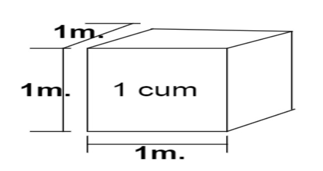
One can measure the rain falling at a place by placing a measuring cylinder graduated in a length
scale, commonly in mm. In this way, we are not measuring the volume of water that is stored in
the cylinder, but the „depth‟ of rainfall. The cylinder can be of any diameter, and we would expect the same „depth‟ even for large diameter cylinders provided the rain that is falling is uniformly distributed in space.
Now think of a cylinder with a diameter as large as a town, or a district or a catchment of a river.
Naturally, the rain falling on the entire area at any time would not be the same and what one would get would be an „average depth‟. Hence, to record the spatial variation of rain falling over an area, it is better to record the rain at a point using a standard sized measuring cylinder.
 |
| Recording Rain gauge |
In practice, rain is mostly measured with the standard non-recording rain gauge the details of which are given in Bureau of Indian Standards code IS 4989: 2002. The rainfall variation at a point with time is measured with a recording rain-gauge, the details of which may be found in IS 8389: 2003. Modern technology has helped to develop Radars, which measures rainfall over an entire region. However, this method is rather costly compared to the conventional recording and non-recording rain gauges which can be monitored easily with cheap labour.
 |
| Non recording rain gauge |
Average rainfall depth
The time of rainfall record can vary and may typically range from 1 minute to 1 day for non -recording gauges, Recording gauges, on the other hand, continuously record the rainfall and may
do so from 1 day 1 week, depending on the make of instrument. For any time duration, the average depth of rainfall falling over a catchment can be found by the following three methods.
• The Arithmetic Mean Method
• The Thiessen Polygon Method
• The Isohyetal Method
1) The Arithmetic Mean Method
Assumed recorded value of rainfall depth have been shown in the table:
Average rainfall as the arithmetic mean of all the records of the four rain gauges, as shown below:
15+12+8+5/4=10mm
2) The Thiessen Polygon Method
This method, first proposed by Thiessen in 1911, considers the representative area for each rain gauge. These could also be thought of as the areas of influence of each rain gauge.
These areas are found out using a method consisting of the following three steps:
1. Joining the rain gauge station locations by straight lines to form triangles.
2. Bisecting the edges of the triangles to form the so-called “Thiessen polygons”
3. Calculate the area enclosed around each rain gauge station bounded by the polygon edges (and the catchment boundary, wherever appropriate) to find the area of influence corresponding to the rain gauge.
3) The Isohyetal Method
This is considered as one of the most accurate methods, but it is dependent on the skill and
experience of the analyst. The method requires the plotting of isohyets as shown in the figure and
calculating the areas enclosed either between the isohyets or between an isohyet and the catchment boundary. The areas may be measured with a planimeter if the catchment map is drawn to a scale.


0 Comments
For more Information Please Comment