
Surveying is defined as “taking a
general view of, by observation and
Process of Surveying
The process of
surveying is therefore in three stages namely
(i) Taking a
general view
This part of the
definition is important as it indicates the need to obtain an overall picture of what is required
before any type of survey work is undertaken. In land surveying, this is achieved
during the reconnaissance study.
(ii) Observation
and Measurement
This part of the definition
denotes the next stage of any survey, which in land
(iii) Presentation of
Data
The data collected in any survey
must be presented in a form which allows the
Types Of Surveying
On the basis of whether the
curvature of the earth is taken into account or not,surveying
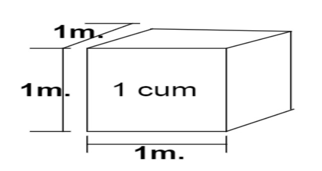
Plane Surveying:- It is the type of
surveying where the mean surface of the earth is considered as a plane. All angles
are considered to be plane angles. For small areas less than 250 km2 plane surveying can safely be used. For most
engineering projects such as canal, railway, highway,
building, pipeline, etc constructions, this type of surveying is used. It is worth
noting that the difference between an arc distance of 18.5 km and the subtended chord lying
in the earth’s surface is 7mm. Also the sum of the
angles of a plane triangle and
the sum of the angles in a spherical triangle differ by 1
Geodetic Surveying:- It is that branch of
surveying, which takes into account the true shape of the earth
(spheroid).
Classification Of Surveying
Surveying is classified based on
various criteria including the instruments used, purpose,
a) Classification on the Basis of Instrument used
Based on the
instrument used; surveys can be classified into
i) Chain tape surveys
ii) Compass surveys
iii) Plane table surveys
iv) Theodelite surveys
b) Classification Based on the surface and the area
1) Land Survey:- Theses are done for object on the surface of the earth. It can be Subdivided into
* Topographic Survey: This is for depicting
the (hills, valleys, mountains, rivers, etc) and manmade features
(roads, houses, settlements…) on the surface of the earth.
* Cadastral Survey: It used to determining
property boundaries including those of fields, houses, plots of land,
etc.
* Engineering Survey: It is used to acquire
the required data for the planning, design and Execution of engineering projects
like roads, bridges, canals, dams, railways, buildings, etc.
* City survey: The surveys involving
the construction and development of towns including roads,
drainage, water supply, sewage street network, etc, are generally referred to as city
survey.
2) Marine or
Hydrographic Survey: Those are surveys of
large water bodies for navigation, tidal
monitoring, the construction of harbours etc.
3) Astronomical Survey: Astronomical survey uses the
observations of the heavenly bodies (sun, moon, stars etc) to fix the absolute locations of places on the
surface of the earth.
c) Classification on Basis of purpose
* Control Survey: Control survey uses
geodetic methods to establish widely spaced vertical and horizontal Control points.
* Geological Survey: Geological survey is used to
determine the structure and arrangement of rock strata.Generally, it enables to know the
composition of the earth.
* Military or Defence Survey: It is carried out to map
places of military and strategic importance.
* Archeological survey: It is Carried out to discover and
map ancient/relies of antiquity.
d) Classification Based On
Instrument Used
1.Chain/Tape Survey:
This is the simple method of taking the linear measurement using a chain or tape with no angular
measurements made.
2. Compass Survey: Here horizontal
angular measurements are made using magnetic compass with the
linear measurements made using the chain or tape.
3. Plane table survey: This is a quick
survey carried out in the field with the measurements and drawings made at
the same time using a plane table.
4. Leveling: This is the
measurement and mapping of the relative heights of points on the earth’s
surface showing them in maps,
plane and charts as vertical sections or with conventional symbols.
5. Theodolite Survey: Theodolite survey
takes vertical and horizontal angles in order to establish controls.
e) Classification based on Method Used
1. Triangulation Survey: In order to make the
survey, manageable, the area to be surveyed is first covered with series of triangles. Lines are
first run round the perimeter of the plot, then the details
2. Traverse survey: If the bearing and distance of a
place of a known point is known. it is possible
to establish the position of that
point on the ground. From this point, the bearing and distances of other surrounding
points may be established. In the process, positions of points linked with lines linking
them emerge. The traversing is the process of establishing these lines, is
called traversing, while the connecting lines joining two points on the ground.
Joining two while bearing and distance is known as traverse. traverse station is each of the
points of the traverse, while the traverse leg is the straight line between consecutive
stations. Traverses may either be open or closed.
* Closed Traverse : When a series of connected lines
forms a closed circuit, i.e. when the finishing point
coincides with the starting point of a survey, it is called as a ‘closed traverse". In Below figure
ABCDE represent a Closed traverse.Closed traverse is
suitable for the survey of boundaries of ponds,
Forest, etc.
 |
| Closed traverse |
* Open Traverse : When a sequence of connected
lines extends along a general direction and does not return to
the starting point, it is known as ‘open traverse’ or (unclosed traverse).Here ABCDEFGH represents
an open traverse.Open traverse is
suitable for the survey of roads, rivers etc.
 |
| open traverse |


0 Comments
For more Information Please Comment